Yacht Draft and Bridge Clearance: How to Plan a Route
Plan yacht passages by checking loaded draft, chart datums, water levels, bridge references and overhead clearance.
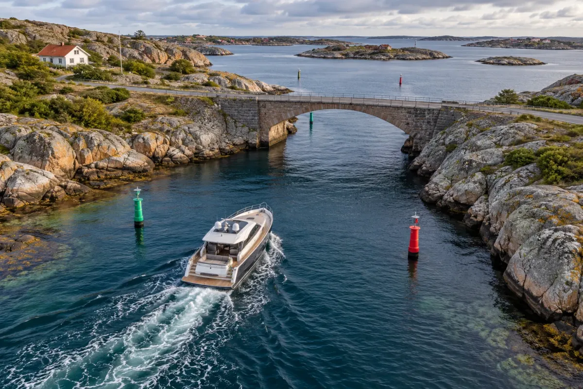
A yacht’s published draft and the depth or bridge height shown on a chart are only starting points for deciding whether a route is passable. Water levels change, charted depths refer to a vertical datum, and a yacht’s operating draft can be affected by load, speed and appendages. Bridge clearance also depends on the water level used as its reference.
This guide explains how to compare a yacht’s loaded draft with charted depth, and its air draft with a bridge’s stated clearance. It is a planning framework, not a route clearance or a substitute for current official charts, local notices and the skipper’s judgment.
Draft and air draft: measure the actual boat
Draft is the vertical distance from the waterline to the deepest underwater point. The controlling point may be a propeller, rudder, keel, pod or other fitting, not the hull itself. A builder may quote draft with a particular load, equipment package or appendage installed, so confirm the exact definition in the vessel’s documentation.
For planning, use the boat’s deepest expected operating draft: include fuel, water, people, stores, tender and equipment. Speed can also matter in shallow water. The U.S. Coast Pilot explains that squat and settlement depend on speed, hull form and depth beneath the keel; an echo sounder’s transducer position can affect the reading too. Slow down where conditions call for it, and follow the vessel and local guidance.
Air draft is the vertical distance from the waterline to the highest fixed point. Include the radar scanner, antennas, hardtop, mast, light, windscreen or other fitted equipment. If any mast or antenna folds, use the actual passage configuration and verify the folding procedure and its limits.
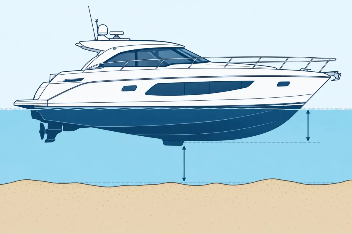
How charted depth relates to under-keel clearance
Soundings on a nautical chart are referenced to a chart datum, not necessarily the water level you see at the moment. NOAA explains chart soundings as water-depth measurements and says the chart identifies the units used. The U.S. Coast Pilot defines charted depth from chart datum and warns that actual tide levels may be lower than predicted and that surveys may not identify every shoal or obstruction. Other countries’ hydrographic offices use their own chart products, datums and conventions, so read the chart notes for the waterway you are navigating.
A useful planning relationship is:
Estimated water depth now − deepest operating draft = preliminary under-keel clearance.
Estimated water depth now must be developed from the charted depth and the appropriate local water-level information. Before relying on the result, account for chart and survey uncertainty, tide or river-level variation, waves, vessel motion, speed-related squat, sounder offset and any required local or company safety margin. There is no single clearance margin that is right for every yacht, seabed, waterway and condition.
NOAA notes that chart accuracy varies with the source survey, its age and the area’s confidence classification. A charted depth is not a guarantee that every point in that area has that depth today. Check the chart’s scale, survey and quality information, latest corrections, notices to mariners and local authority guidance.
Bridge clearance changes with water level
A bridge’s published vertical clearance is measured from a stated water-level reference. As the water rises, the available clearance beneath a fixed bridge falls; as it falls, clearance increases. The number may be expressed at a local datum or water stage, so confirm the reference used by the official source and how it relates to current conditions.
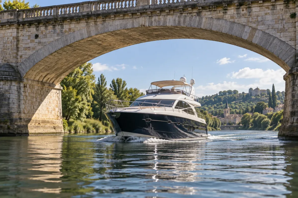
For U.S. waterways, the Coast Guard’s bridge-clearance guidance explains its clearance references; NOAA Coast Pilots may give bridge details where applicable. In other regions, use the relevant national hydrographic office, maritime authority, official bridge operator and local water-level service. A general bridge-clearance guide or old cruising note is not a substitute for the current local source.
Allow for the yacht’s actual height and movement, including antenna or mast configuration, wave motion and the accuracy of the clearance information. If the available clearance is close, do not try to make the passage based on visual estimation alone. Obtain reliable local information or select another route.
Make a route check for the whole passage
Draft and overhead clearance must work at every restriction, not just at the destination. Identify the shallowest controlling depth and lowest overhead obstruction along the intended route. Check marina entrances, channels, bridge spans, cables, locks, river reaches and any narrow approach.
- Identify the exact boat: note its deepest loaded draft and highest air draft in the planned passage configuration.
- Use current official information: check the appropriate chart, chart notes, notices to mariners, bridge sources and tide or river-level predictions for the route and date.
- Check the vertical references: understand the chart datum for depths and the reference water level for each bridge height.
- Assess conditions: consider current water level, forecast rain or river flow, wind setup, waves, vessel speed and loading.
- Set a conservative go/no-go decision: use the vessel’s operating guidance and local authority recommendations; do not rely on a generic internet margin.
- Plan an alternative: identify a route, waiting area or safe place to stop if the actual water level, visibility or conditions differ from the plan.
- Recheck before the restriction: compare current observations with the plan, verify sounder offset and speed, and ask the local authority or bridge operator if information is uncertain.
Simple worksheet for your yacht
- Boat and model year: __________
- Deepest draft in the expected loaded condition: __________
- Highest air draft in the intended configuration: __________
- Shallowest charted or controlling depth and its datum: __________
- Water-level source, reference and forecast time: __________
- Lowest bridge clearance and its reference water level: __________
- Latest chart corrections and local notices checked: __________
- Route alternative and decision point: __________
Common planning mistakes
- Using brochure draft without checking load, appendages or equipment.
- Assuming a charted sounding is the depth at the present water level.
- Comparing water level and chart depth that use different vertical datums.
- Using a bridge height without checking its stated reference stage.
- Ignoring survey age, chart scale, tide timing, river level, waves or speed.
- Trusting a depth sounder without checking its transducer offset or the bottom directly ahead.
- Continuing when actual conditions no longer match the route plan.
Frequently asked questions
Does a charted depth show the water depth right now?
Not by itself. Charted depths are referenced to the chart’s datum. Use the chart notes and current local water-level information to assess present depth, while allowing for survey and environmental uncertainty.
Is published yacht draft enough for a shallow-water passage?
It is only a starting point. Confirm the deepest operating condition and underwater appendages, then assess charted depth, water level, vessel motion, speed and the required clearance for that waterway.
Does bridge clearance change with the tide?
For a fixed bridge, the vertical space above the water decreases as the water rises and increases as it falls. Check the published reference level and current local water stage.
Is there one safe under-keel clearance rule for every yacht?
No single margin applies in every setting. Depth accuracy, bottom, tide, speed, hull form, wave conditions and local procedures all affect the decision. Follow official local guidance and the vessel’s operating recommendations.